The proposals for the site have been influenced by a number of factors including existing planning policy allocations, the adopted Masterplan Framework and technical site constraints as set out below.
Barnsley Local Plan
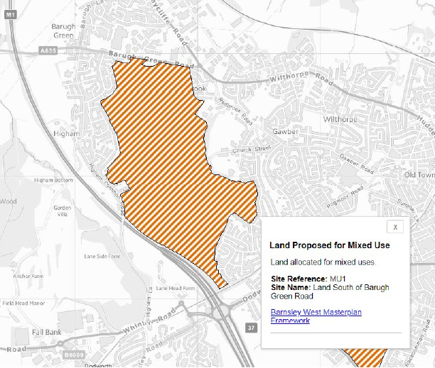
The Barnsley West site is part of the MU1 site allocation within the Barnsley Local Plan, January 2019. Policy MU1 allocates the site for mixed-use development to provide some 1,700 new homes; 43 hectares of employment land; new infrastructure including a link road and drainage; a new primary school; small shops and community facilities; open green space with wildlife corridors; and key pedestrian and cycle paths.
Barnsley West Masterplan Framework
Following adoption of the Local Plan, Sterling Capitol and Strata Homes worked in collaboration with Barnsley Metropolitan Borough Council to prepare the Masterplan Framework. The Masterplan Framework was adopted in December 2019, which provides the vision and guidance for delivery of the site.
Barnsley West Masterplan Framework can be viewed
here
Coal Mining History
The Barnsley Region is draped in a rich history of mining related to the once thriving coal industry. Following a review of archived Coal Authority plans and undertaking ground investigations, it has been confirmed that historical methods of mining once took place on site from 1945.
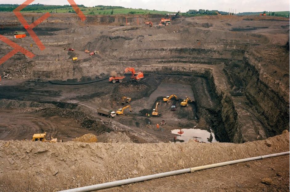
Photo showing the sort of activity that once took place on the site.
The former opencast mines reached depths of 45m and were backfilled to present day site levels; presenting a constraint for the location of development. The outer boundaries of the former opencast pits all present challenges and the former highwalls represent zones where the depth of fill may range from 45m deep to 0m. Site preparation works, including earthworks will be required to address these constraints.
Opportunities for the site
The Developers have undertaken a significant amount of technical work which informed the adopted Masterplan Framework. This work has been developed further to guide the development proposals for the site.
The ground conditions of the site have been affected by previous open-cast mining, so there are areas where development is restricted. This gives the opportunity to create open green spaces across the site. The site has an existing network of public rights of ways and footpaths across the site, which will be maintained through the site.
Key areas of woodland, watercourses and hedgerows have been identified and these will be maintained or improved to create a high-quality and sustainable green environment.
The development will also provide sustainable drainage systems which are environmentally friendly ways of dealing with surface water drainage. Habitats for existing wildlife will be improved in the open space areas.
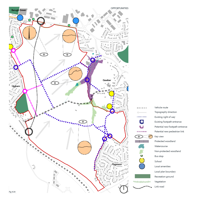
In 2020 the Developers secured planning permission for the delivery of highways improvements works required to unlock the allocated site and associated benefits in developing this key site. The permissions include a northern roundabout on Barugh Green Road and a southern roundabout on Higham Lane between the M1 motorway bridge and Hermit Lane.